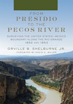
From Presidio to the Pecos River
Surveying the United States–Mexico Boundary along the Rio Grande, 1852 and 1853
Published by: University of Oklahoma Press
Imprint: University of Oklahoma Press
Foreword by David H. Miller
Published by: University of Oklahoma Press
Imprint: University of Oklahoma Press
312 Pages | 7 x 10 | 34 b&w illus., 23 maps, 3 tables
$39.95
$34.95
$26.95
“The agreement reached in the Treaty of Guadalupe Hidalgo of 1848, which ended the U.S. war with Mexico, required an accurate survey of the new international boundary between Mexico and the United States…From Presidio to the Pecos River by Orville B. Shelburne provides a detailed account of the survey parties, led by Marine Tyler Wickham Chandler in 1852 and Nathaniel Michler in 1853, which completed the mapping of this region… The greatest strengths of From Presidio to the Pecos River are its outstanding maps and illustrations. Throughout the book, Shelburne offers juxtaposed images of historical sketches alongside high-quality, present-day photographs, as well as comparisons of sections of the survey maps with present-day maps and aerial imagery. Any cartophile will be thoroughly impressed by the outstanding cartographic design displayed throughout Shelburne’s book.”--- Southwestern Historical Quarterly
This website uses cookies so that we can provide you with the best user experience possible. Cookie information is stored in your browser and performs functions such as recognising you when you return to our website and helping our team to understand which sections of the website you find most interesting and useful.
Strictly Necessary Cookie should be enabled at all times so that we can save your preferences for cookie settings.
If you disable this cookie, we will not be able to save your preferences. This means that every time you visit this website you will need to enable or disable cookies again.

